
I had another good launch, thankfully. I have to admit being a little nervous with an instructor and a bunch of other participants watching closely, and video being recorded for analysis. Especially after the first person to launch on our first day got a pretty severe critique. Luckily the worst comment I got was that my launches were too “casual”. i.e. I could add a little more energy.
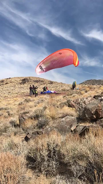
Our last flight was from the Paiute launch (or Piute?). This launch is up a very steep, narrow, rocky road and I was glad I wasn’t driving! Our instructor (Kari) launched early to try to give us some guidance in the air. I caught some lift right away. Launch is about 2430 m (8000 ft) and I managed to make it to 2760 m (9000 ft) not long into the flight. But the thermals were broken and most didn't seem to go very high.
After about 25 min I was getting low and approaching "last chance hill". I wasn't having any luck finding another thermal and I was pretty sure I was headed for the LZ (landing zone). Some of the other people had already landed, but frustratingly there were also a bunch of people managing to stay up above.
Meanwhile, Kari got on the radio to say she had hopped over to the next spine to the north (downwind). In my struggles to stay up I had lost track of her, and I was in no position to follow anyway. One of the other participants was higher and seemed to be heading in that direction. I was bummed that they were going to head out while I sank. :-(
Then I felt a little something and tried to head for what I hoped would be some lift. Sure enough I found a thermal and managed to climb from my low of 2080 m back up to 2360 m (about a thousand foot climb). Not super high (still below launch) but enough (I hoped) to take a stab at heading north. Thankfully I found another small thermal on the way and topped up to 2400 m.
Chasing Kari really made me realize just how big the Owens Valley is. From the bottom of the valley to the top of the mountains is about 10,000 feet, almost two miles! Even though we were in just one tiny corner, her glider ahead of me looked tiny relative to the scenery.
By the time I caught up at the next spine I was down to about 2000m. But I was higher than Kari, and could see there was some lift. We searched together, finding little bits of choppy lift but only enough to maintain.
Eventually Kari decided to head out towards the highway in the valley. I had tried to stay above Kari to give myself some margin since she was way more skilled and on a better glider. But by this point I was below her. I was pretty sure I wouldn't make the highway from my present height so I decided to search a bit more. Worst case I'd just land a bit shorter. Best case I'd find another thermal. In paragliding, more height is like more gas in the tank, allowing you to make a longer glide. Just as I was about to give up, at 1660 m, I felt a tug on the wing and turned into the best climb of the flight. It was about 3 m/sec (600 ft/sec) - not super strong but decent. I managed to hang onto it till 2180 m (climbing about 1700 ft).
Meanwhile, Kari hadn't found any lift in the valley and had landed, short of the highway as I had figured, but on a side road for an easy retrieve. Up high, I could relay her position by radio to the rest of the group.
Now I had a decision - should I try to continue north along the foothills? I headed towards the hills but right away changed my mind and decided to use my height to glide out to the highway. Without Kari, I was a little nervous about continuing and landing somewhere with a long hike out to the nearest road. The rough conditions were another factor in the decision.
I hoped for some thermals over the valley, but I didn't find much. I angled to intersect the highway at a decent height to pick an LZ. As I approached I had my eye on a clear spot next to the road.
 |
| huge landing strip next to the highway (image courtesy of Google maps) |
It turned out to be a large pullout with a couple of piles of gravel but no power-lines or barbed wire fences. Of course, there was no windsock or streamers so it was a little hard to judge the wind. I almost landed short since the wind was stronger than I guessed (poor judgement) but in the end I made a good no-step landing on the end of the pullout and laid my glider down on pavement (much preferable to the sagebrush!)
While I still had radio coverage from the air I let them know where I was landing. After landing I was out of radio contact and had no cell phone coverage, so I was happy to have my inReach satellite gps/messenger to pass on my exact location.
Here's a 3D visualization of my flight (watch it fullscreen for best view).
The flight only lasted an hour and ten minutes, I've had longer flights. But it was my longest in straight line distance - 13 km. In overall paragliding terms, that's nothing, people routinely fly hundreds of kilometers, but it was satisfying for me, nonetheless. And it was the best flight anyone in our group managed in the three days we spent with Kari.
No comments:
Post a Comment