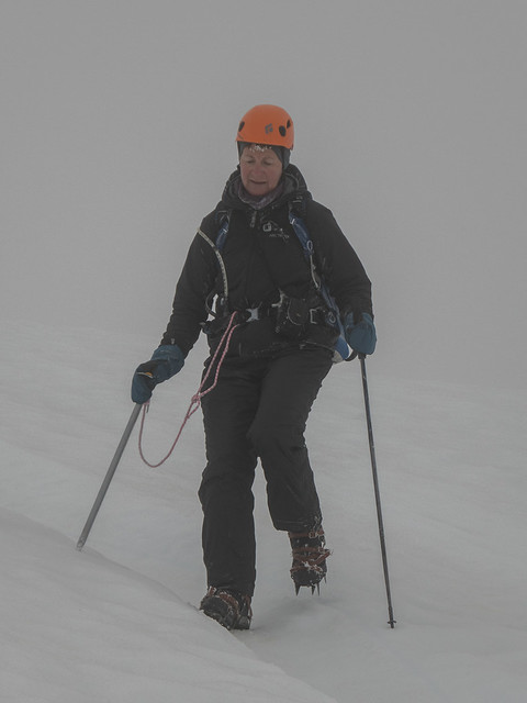
Since Woodrat, where we were paragliding, is close to Mt. Shasta (14,180 ft / 4320 m) we had planned to try climbing it. The normal route (Avalanche Gulch) is on snow, but not crevassed glacier, so we didn't need a rope, but we did need to dig out our ice axes and crampons, which shamefully have not seen much action lately.
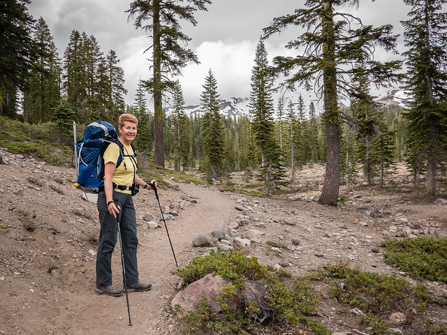
We started at the Bunny Flat Trailhead at 6940 ft. The scene at the parking lot brings back many memories. People with gear strewn over the pavement trying to get their stuff together. Even though we haven't done much alpine climbing lately, we've had lots of practice and it didn't take us long to throw our packs together. (I did forget my toothbrush, but I survived.)
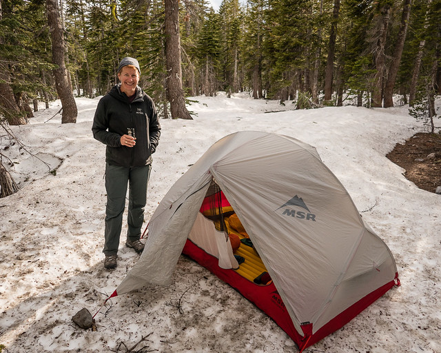
Most people camp at Helen Lake at 10,440 but that's a long slog with a big pack. We chose to camp at Horse Camp (7900 ft) instead. It's only about an hour hike so we headed up about 5 pm. At Helen Lake you need to melt snow, but there's running water at Horse Camp so we didn't need to carry a stove. (A few people climb in a day from the parking lot, but I enjoyed camping at Horse Camp. And it's easier to get an early start if you're already on the mountain.)
Camping lower meant we had a longer climb the next day, but we could do it without big packs, and early in the morning when the snow was hard. It was a dark night but luckily the route is straightforward since all we could see was the circle of snow illuminated by our headlamps. Shelley went first. She claimed this was so she didn't have to "keep up with me". Instead, I had to keep up with her fast pace! We left Horse Camp about 3am and reached Helen Lake at about 5am. Two hours for 2500 ft is respectable, although there was a time when we could crank that out in an hour. We could see some lights above us on the route, but there were also people leaving Helen Lake after we passed.
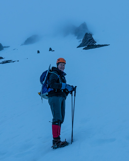
Soon after Helen Lake it got light enough to put away our headlamps, and steep enough to put on our crampons and switch from hiking poles to ice axe. The route isn't especially steep, but the snow was hard and icy so you'd have a long slide if you slipped. Unfortunately, with the light we could now see that the clouds were just above us. And the higher we climbed, the windier it got.
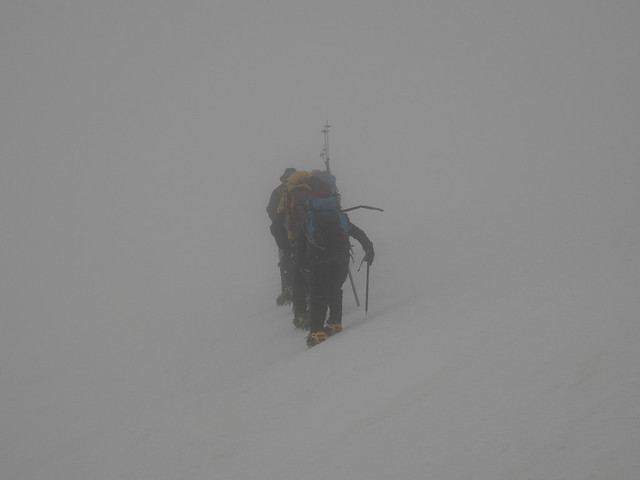
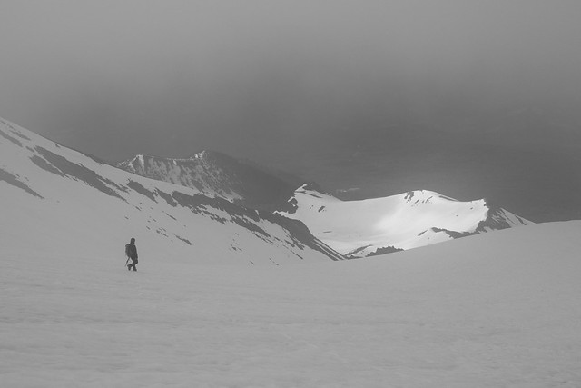
Our first hint of things to come was a sole climber descending out of the cloud. We assumed he wasn't feeling well. Then another group descended, close enough to tell us the weather was awful up above. We continued on. There was a guided group above us and we figured they'd know which way to go and we could follow them. But as we ascended, more and more people passed us heading down. Eventually the wind, lack of visibility, cold, and frost forming on us was too much and we joined the procession headed down. We reached a high point of about 12,200 ft in roughly 4 hours, not bad for a couple of old farts. Although at that point I could start to feel the altitude slowing us down. A bit later, looking back up, we could see what looked like everyone on the route headed down.
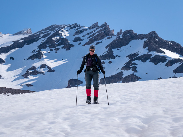
The frustrating part was that as we descended, the clouds gradually lifted and cleared, and soon we were descending in beautiful sunny weather. Although judging by the speed of the clouds flying by it was still very windy up high.
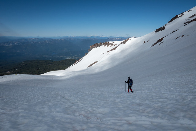
This route on Shasta is well known for long glissades down, but the snow was hard, icy, and rough and we just walked down. It didn't take long to descend to Horse Camp, pack up our tent, and hike out to the car.
For more of these photos, see all 17 photos as a slideshow or overview
We started at the Bunny Flat Trailhead at 6940 ft. The scene at the parking lot brings back many memories. People with gear strewn over the pavement trying to get their stuff together. Even though we haven't done much alpine climbing lately, we've had lots of practice and it didn't take us long to throw our packs together. (I did forget my toothbrush, but I survived.)
Most people camp at Helen Lake at 10,440 but that's a long slog with a big pack. We chose to camp at Horse Camp (7900 ft) instead. It's only about an hour hike so we headed up about 5 pm. At Helen Lake you need to melt snow, but there's running water at Horse Camp so we didn't need to carry a stove. (A few people climb in a day from the parking lot, but I enjoyed camping at Horse Camp. And it's easier to get an early start if you're already on the mountain.)
Camping lower meant we had a longer climb the next day, but we could do it without big packs, and early in the morning when the snow was hard. It was a dark night but luckily the route is straightforward since all we could see was the circle of snow illuminated by our headlamps. Shelley went first. She claimed this was so she didn't have to "keep up with me". Instead, I had to keep up with her fast pace! We left Horse Camp about 3am and reached Helen Lake at about 5am. Two hours for 2500 ft is respectable, although there was a time when we could crank that out in an hour. We could see some lights above us on the route, but there were also people leaving Helen Lake after we passed.
Soon after Helen Lake it got light enough to put away our headlamps, and steep enough to put on our crampons and switch from hiking poles to ice axe. The route isn't especially steep, but the snow was hard and icy so you'd have a long slide if you slipped. Unfortunately, with the light we could now see that the clouds were just above us. And the higher we climbed, the windier it got.
Our first hint of things to come was a sole climber descending out of the cloud. We assumed he wasn't feeling well. Then another group descended, close enough to tell us the weather was awful up above. We continued on. There was a guided group above us and we figured they'd know which way to go and we could follow them. But as we ascended, more and more people passed us heading down. Eventually the wind, lack of visibility, cold, and frost forming on us was too much and we joined the procession headed down. We reached a high point of about 12,200 ft in roughly 4 hours, not bad for a couple of old farts. Although at that point I could start to feel the altitude slowing us down. A bit later, looking back up, we could see what looked like everyone on the route headed down.
The frustrating part was that as we descended, the clouds gradually lifted and cleared, and soon we were descending in beautiful sunny weather. Although judging by the speed of the clouds flying by it was still very windy up high.
This route on Shasta is well known for long glissades down, but the snow was hard, icy, and rough and we just walked down. It didn't take long to descend to Horse Camp, pack up our tent, and hike out to the car.
For more of these photos, see all 17 photos as a slideshow or overview
No comments:
Post a Comment